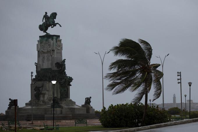
Hurricane Ian hit the western part of Cuba early Tuesday morning leaving a trail of destruction due to strong winds. It is forecast that in the next few hours it will cross the island in a northerly direction to advance towards Florida.
The meteor hit with gusts of 208 kilometers per hour, experts told local media, in the small town of San Juan y Martínez, where one of the best tobaccos in the world is produced but is relatively sparsely inhabited. The wall of the eye penetrated the vicinity of a beach called La Coloma, in the province of Pinar del Río.
Local authorities set up 55 shelters, sent medical and emergency personnel and took measures to protect food and other crops in warehouses in the tobacco region, according to state media. The tobacco industry protected pastures and nurseries, as well as drying houses. Pinar del Río concentrates 80% of the island’s production.
It is forecast that its departure will take place in the vicinity of Puerto Esperanza to continue heading north at the end of the morning. The eye of the cyclone passed over the main city, Pinar del Río, where it was clear – a characteristic phenomenon of the cyclone axis – before dramatically increasing its strength.
“The hurricane continues over the city of #PinardelRío, the eye of the system crosses the city. Don’t be careless!” Official media outlets alerted to the apparent calm that was followed by gusts of wind, falling telephone poles, flooding with people with water up to their waists, curtains of water and large shaken trees, as seen in photos and videos shown on social networks.
The United States National Hurricane Center (NHC) predicted that areas of the west coast of Cuba could register storm surges of up to 4.3 meters.
“Extreme hurricane-force winds are expected for Cuba, as well as dangerous storm surges and heavy rains,” Daniel Brown, a meteorologist with the Center, told The Associated Press on Monday.
In the morning, the NHC issued a public advisory stating that Ian was “battling western Cuba with life-threatening high winds and storm surge.” It was located 15 kilometers northeast of the city of Pinar del Río and 240 kilometers southwest of Dry Tortuga with a movement of 19 kilometers per hour.
In a provisional count, no loss of human life was reported, but the authorities reported damage to homes with light roofs blown up, water deposits and falling windows, while electrical and telephone services were cut by 100%.
Some 50,000 people, residents of low-lying or coastal areas, had been preventively evacuated the day before.
Resident and social communicator Fátima Rivera described the first hours of daylight on her Twitter account as “a bleak dawn.”
In Havana it rained intermittently since dawn and there were strong gusts of wind. Fishermen pulled their boats out of the water along the iconic boardwalk on Monday as city employees were busy cleaning out drains in anticipation of heavy rains.
Adyz Ladrón, a 35-year-old Havana resident, expressed concern about the possibility of rising water levels, which can be serious in low-lying areas.
“Scared because the house is completely flooded, the water reaches high,” she said.
From the province of Cienfuegos it was reported that technicians have already begun to be sent to repair the electrical service.
Ian arrived in Cuba as a category 3 storm and continued to gain strength with sustained winds of 205 km/h (125 mph), according to the NCH report.
