
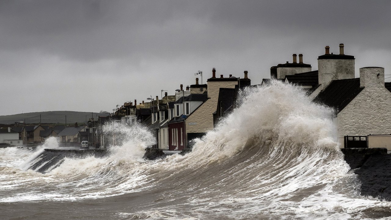
A storm surge is an abnormal rise in seawater level during a cyclone or intense storm, measured as the height of the water above the normal predicted astronomical tide. Powerful onshore winds push ocean water toward the shore, where the shallow seafloor forces the circulating water upward and inland, while low atmospheric pressure adds a small secondary lift. When this dome of water combines with normal high tides, breaking waves, and heavy rain runoff, it overwhelms shorelines and causes severe coastal flooding.
Forecasters treat surge as one of the most dangerous hazards of any coastal storm because moving seawater weighs roughly 1,700 pounds per cubic yard and can submerge neighborhoods miles inland within hours. Understanding how the ocean floor, wind field, and astronomical tide interact explains why two storms with the exact same wind speed can produce vastly different flood levels.
How does a storm surge push seawater inland and cause coastal flooding?
Many people assume low barometric pressure at the center of a hurricane or cyclone sucks the ocean upward like a giant straw. In reality, low atmospheric pressure plays a minor role known as the inverse barometer effect, raising the sea level by roughly 1 centimeter for every 1 millibar drop in air pressure, according to the UK Met Office (2025). The main engine behind every storm surge is wind.
As strong winds swirl around a storm, friction drags ocean water across the surface and sets up a vertical circulation loop beneath the waves. Out in the deep open ocean, that downward and return flow moves freely through deep water, so the storm creates very little detectable rise at the surface, according to NOAA’s National Hurricane Center (2026).
Once the storm approaches land and crosses onto the shallow continental shelf, the ocean bottom blocks that vertical return circulation. Because the water pushed toward shore can no longer circulate downward and escape back out to sea, it piles up against the coast and is forced upward and inland over beaches, seawalls, and coastal roads.
That dome of wind-driven water is only one piece of what meteorologists call the Total Water Level. As defined by the US National Weather Service (2021), total coastal inundation comes from four combined forces:
- Storm surge pushed ashore by wind and low atmospheric pressure.
- Astronomical tides driven by the gravitational pull of the moon and sun.
- Breaking waves riding on top of the elevated water, which push water even higher up the beach through wave runup and wave setup while battering structures.
- Freshwater input from heavy storm rainfall that swells inland rivers and streams, flowing downriver into bays, deltas, and estuaries where it collides with incoming seawater.
What is the difference between a storm surge and a storm tide?
Weather broadcasts often use storm surge and storm tide interchangeably, but oceanographers measure them differently. According to NOAA’s National Ocean Service (2026), storm surge is strictly the water height generated by the storm itself above the predicted astronomical tide, whereas storm tide is the total observed water level combining the storm surge and the normal astronomical tide.
Because storm surge measures a difference above the normal tide rather than a fixed elevation, timing makes an enormous difference depending on local tidal patterns. Most of the US Gulf of Mexico experiences a diurnal tide with one high tide and one low tide each day and a relatively small tidal range. In contrast, the US East Coast and the United Kingdom experience semi-diurnal tides with two high tides and two low tides every day and much larger swings between high and low water (US National Weather Service, 2021; UK Met Office, 2025).
Along coastlines with large tidal ranges, a shift of just two hours in a storm’s landfall can determine whether communities face catastrophic inundation or minor splashover. The worst coastal flooding happens when a storm surge arrives during a spring tide around a new or full moon, when the sun, moon, and Earth align to pull normal high tides to their highest levels of the month (NOAA National Ocean Service, 2026).
Why do some weaker storms cause worse flooding than major cyclones?
A common misconception is that a storm’s wind category tells you how high the water will rise. While meteorological agencies classify cyclones by their sustained wind speeds, wind intensity is only one of six physical factors that control storm surge height (NOAA National Hurricane Center, 2026).
| Factor | Produces Higher Storm Surge | Produces Lower Storm Surge |
|---|---|---|
| Wind Intensity | Higher sustained wind speeds (a 15 mph increase measurably raises surge) | Lower sustained wind speeds |
| Storm Size | Wide radius of maximum winds pushing water over a vast ocean area | Compact wind field acting on a narrow strip of ocean |
| Forward Speed | Faster storms (25 mph) on open coasts; slower storms (5 mph) inside bays and estuaries | Slower movement on open coasts; faster transit across enclosed bays |
| Angle of Approach | Track moving perpendicular to the coastline | Track moving parallel or at an oblique angle to the coast |
| Seafloor Slope (Bathymetry) | Wide, gently sloping continental shelf (such as the US Gulf Coast) | Narrow, steeply dropping shelf (such as southeastern Florida) |
| Coastline Shape | Concave, inward-curving bays (such as Florida’s Apalachee Bay) | Convex, outward-curving points (such as North Carolina’s Outer Banks) |
A real-world comparison from the US National Weather Service (2021) shows how storm size and seafloor slope regularly outweigh wind category. When Hurricane Charley struck southwestern Florida in 2004 as a ferocious Category 4 hurricane, its compact radius of maximum winds generated a storm surge of 6 to 8 feet. Four years later, Hurricane Ike made landfall in Texas as a Category 2 hurricane, but its massive wind field pushed water across the wide, shallow Texas continental shelf to drive a 20-foot storm surge.
Forward speed also changes where the flooding hits hardest. According to a 2021 forecasting guide from the World Meteorological Organization, a fast-moving storm traveling at 25 mph produces a higher peak surge right along the open coast. However, a slow-moving storm crawling at 5 mph blows onshore for so many hours that it forces far greater volumes of water deep into inland bays, sounds, and estuaries.
What are the deadliest historical examples of storm surge?
History shows that storm surges do not only come from tropical hurricanes and cyclones; intense mid-latitude low-pressure systems can trigger devastating surges in cooler seas as well. Both tropical and extratropical surges have reshaped modern flood engineering.
In August 2005, Hurricane Katrina pushed an expansive wind field across the shallow continental shelf of the northern US Gulf Coast. Even though Katrina had weakened from its peak wind strength before landfall, the water already piled against the shallow shelf generated a storm surge exceeding 8 meters (more than 25 feet) along parts of the Mississippi and Louisiana coast, overwhelming New Orleans’ levee defenses and contributing to more than 1,800 deaths (UK Met Office, 2025; US National Weather Service, 2021).
In northwestern Europe, the night of January 31, 1953, demonstrated the danger of an extratropical North Sea storm surge coinciding with a high spring tide. Gale-force winds funneling southward down the narrowing North Sea piled water against the coasts of the United Kingdom, the Netherlands, and Belgium, killing more than 2,500 people around the North Sea coastline, including 307 in England and 19 in Scotland, and prompting the construction of the Thames Barrier to protect London (UK Met Office, 2025).
Frequently asked questions
How is a storm surge different from a tsunami?
A tsunami is generated by sudden seafloor movement, such as an underwater earthquake or landslide, which displaces the entire column of ocean water from the seafloor to the surface and arrives at the coast as a series of rapid wave crests and troughs 10 to 45 minutes apart. A storm surge is driven by surface winds and air pressure over shallow coastal waters, building gradually over hours and keeping sea levels elevated for hours or days.
Can a storm cause coastal water levels to drop instead of rise?
Yes. When strong winds on the backside or offshore side of a cyclone blow water away from the coastline rather than toward it, they create what meteorologists call a negative storm surge. According to the UK Met Office (2025), negative surges lower water levels well below the normal low tide and can leave large ships grounded or damaged in shallow harbors and shipping channels.
How do meteorologists measure and forecast storm surge?
During a storm, permanent coastal tide stations record the total water level continuously, and meteorologists subtract the known astronomical tide prediction to isolate the exact storm surge height, supplemented by temporary barometric water-pressure sensors deployed along the coast ahead of landfall (US National Weather Service, 2021). To predict surge before landfall in the United States, the National Hurricane Center runs thousands of simulations using the SLOSH (Sea, Lake, and Overland Surges from Hurricanes) computer model to issue Probabilistic Storm Surge maps (WMO, 2021).