
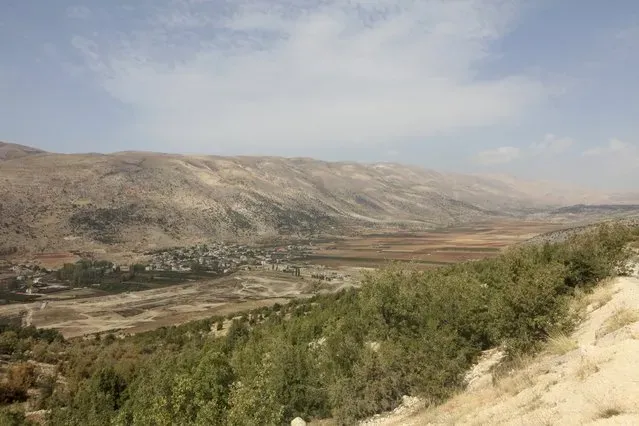
The Litani River is the longest waterway entirely within the borders of Lebanon, stretching approximately 108 miles, or 174 kilometers. It dictates agricultural survival for the nation while functioning as a hard military line for foreign armies. At its closest geographic point to the Israel-Lebanon border, the river bends westward to flow into the Mediterranean Sea. The distance between that river bend and the border, known as the Blue Line, is approximately 18 to 20 miles.
This 30-kilometer gap of land is the core of a decades-long territorial dispute. Governments and military planners view the river not just as a water source, but as a natural geographic barrier. Control over the territory south of the Litani determines the security posture of the entire region. The river defines where armed groups operate, where peacekeepers deploy, and where residents can safely live.
Water access and military defense overlap constantly along the river’s path. The Litani originates in the Bekaa Valley, just west of Baalbek, flowing directly south through Lebanon before making its sharp western turn near Sidon. This specific topography places the country’s most critical agricultural resource directly inside an active combat zone.
Background: How We Got Here
The idea of using the Litani as a border predates the modern states of the Middle East. Early Zionist leaders looked at the geography of the region and identified the waterway as a necessary boundary. In 1919, David Ben-Gurion wrote about the river, which was referred to as the Qasmiyeh at the time. He stated that the Litani should be the dividing line and the “northern border of the Land of Israel.”
Decades later, that geographic ambition turned into active military operations. By the late 1970s, the Palestine Liberation Organization launched attacks into northern Israel from southern Lebanon. In 1978, the Israeli army invaded the area. The military explicitly named the campaign “Operation Litani.” Their primary objective was to physically push PLO forces north, across the river banks, clearing the 18-mile gap of armed fighters.
The fighting escalated a few years later. The First Lebanon War began in 1982, and Israel once again advanced to the river. The army captured territory all the way up to the Litani, including the area surrounding Lake Qaraoun. Israel formally withdrew from the immediate riverbanks in 1985. But the Israeli military did not leave southern Lebanon entirely. They maintained a joint “security zone” in the region alongside the South Lebanon Army. That arrangement lasted until the year 2000, when Israel completed a full withdrawal.
Six years later, the river became a frontline again. In 2006, a 34-day war broke out between Israel and Hezbollah. The Israel Defense Forces launched a ground invasion. Their stated goal was to push Hezbollah fighters north of the Litani River and establish a permanent military buffer zone. The ground offensive ended without securing that objective. But the river became the defining term of the ceasefire.
In August 2006, the United Nations Security Council unanimously adopted Resolution 1701 to end the hostilities. The mandate officially ordered the creation of a weapons-free buffer zone. This zone spanned the exact 18 to 20 miles of land between the Blue Line and the Litani River.
The rules of Resolution 1701 were strict. No armed personnel, weapons, or military infrastructure could exist south of the Litani. The text made only two exceptions. Official forces of the Lebanese government could operate there, along with the United Nations Interim Force in Lebanon. UNIFIL peacekeepers operated under a troop limit of 15,000 personnel.
Implementation failed almost immediately. International observers and the Israeli government reported that Hezbollah did not disarm. In the years following the 2006 war, the group re-established its military infrastructure throughout the territory south of the Litani River.
Key Players and Stakeholders
The Lebanese government holds legal sovereignty over the Litani River. Recognizing the waterway’s vital economic function, the state established the Litani River Authority in 1954. The World Bank backed the project heavily. During the 1960s, the authority managed the construction of the Qaraoun Dam. The dam provides hydroelectric power and regulates irrigation for the nation’s farmers.
Israel views the river primarily through a military lens. The geographic distance from the border makes it the only natural barrier capable of separating short-range threats from northern Israeli towns. Clashes along the border escalated throughout 2023 and 2024. A short-lived ceasefire agreement announced on November 26, 2024, centered entirely on Israel’s demand that Hezbollah retreat north of the river.
By early 2026, the region entered a new phase of intense conflict tied to broader, Iran-related hostilities. The Litani returned to the center of Israeli geopolitical planning. In late March 2026, Israel announced its explicit intent to occupy southern Lebanon. The government stated it would push up to the Litani to physically enforce the buffer zone itself.
Political rhetoric in Israel quickly followed the military announcements. Israeli Finance Minister Bezalel Smotrich publicly stated that Israel should annex Lebanese territories up to the Litani. Concurrently, Defense Minister Israel Katz affirmed that the military would take control of a security zone stretching to the river until Hezbollah threats were entirely neutralized.
What’s at Stake
Food security is the immediate domestic casualty of the conflict. The Litani River is the agricultural lifeline for Lebanon. Its waters irrigate the Bekaa Valley. This specific valley contains nearly half of all arable land in Lebanon. The farms rely on the river to grow grains, fruits, and vegetables for the domestic market.
Ongoing military campaigns severely disrupt these operations. The military focus heavily impacts the overwhelmingly Shiʿi population living in southern Lebanon. The ongoing cycle of displacement pulls farm workers away from the highly fertile areas surrounding the waterway. Strikes and the physical enforcement of the buffer zone halt harvests, damaging the national food supply.
For Israel, the stakes revolve entirely around the physical distance of the buffer. Maintaining empty space between the Blue Line and the Litani removes the launch sites used for short-range rockets and border incursions. The Israeli government insists that the enforcement of the Litani buffer zone guarantees the safety of its northern residents.
The civilian toll continues to rise as both sides use the river as a hard line for their respective national interests. Lebanon needs the water to feed its population. Israel needs the land south of the water to secure its border. These two overlapping dependencies keep the 108-mile river at the center of Middle Eastern military planning.
Frequently Asked Questions
What is UN Security Council Resolution 1701?
Resolution 1701 is an international mandate adopted in 2006 to end the Second Lebanon War. It calls for a permanent ceasefire between Israel and Hezbollah. The resolution established a specific buffer zone between the Israel-Lebanon border (the Blue Line) and the Litani River. The mandate states that no armed personnel or weapons are permitted inside this zone, except for official Lebanese state forces and UNIFIL peacekeepers.
Why is the Litani River important to Lebanon?
The Litani is the longest river located entirely within Lebanon. It provides critical irrigation for the Bekaa Valley, an area that holds nearly half of the country’s arable land. The river supports the growth of vegetables, fruits, and grains. Furthermore, structures built on the river, like the Qaraoun Dam, generate essential hydroelectric power for the country.
How far is the Litani River from the Israeli border?
The river flows south through Lebanon before making a sharp bend to the west toward the Mediterranean Sea. At this westward bend, it runs parallel to the Israel-Lebanon border, known as the Blue Line. The distance between the river and the border at this point is approximately 18 to 20 miles, or roughly 30 kilometers.