
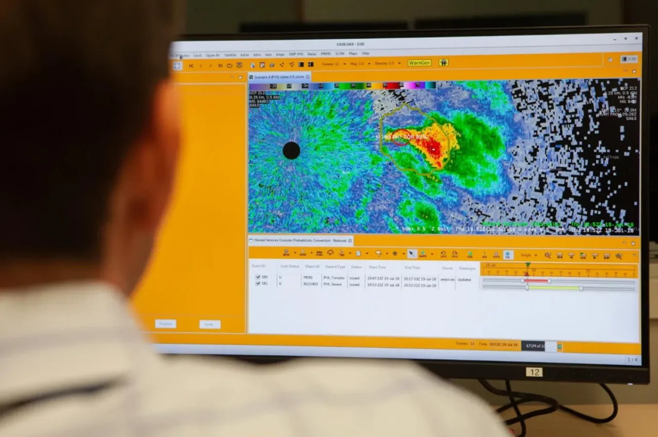
A NEXRAD Doppler weather radar works by firing short, high-powered bursts of S-band microwave energy from a rotating 28-foot parabolic dish and listening for the tiny fraction of energy that scatters back off raindrops, snowflakes, hail, or airborne debris. By measuring the round-trip travel time, strength, and wave phase shift of those returning echoes in both horizontal and vertical orientations, the system calculates a storm’s distance, precipitation rate, wind speed, and particle shape.
Operated jointly by the National Weather Service (NWS), the Federal Aviation Administration (FAA), and the Department of Defense (DoD), the Next Generation Weather Radar network comprises 160 operational sites across the United States and select overseas locations, according to 2026 data from the NOAA National Centers for Environmental Information (NCEI) and a July 2026 Congressional Research Service report. Meteorologists know the individual radar unit by its technical designation, the WSR-88D, which stands for Weather Surveillance Radar, 1988 Doppler.
How does a NEXRAD Doppler weather radar measure rain and distance?
Inside each white fiberglass dome sits an 8.53-meter (28-foot) parabolic aluminum dish antenna paired with a transmitter and receiver known as the Radar Data Acquisition (RDA) unit, according to engineering specifications from the NOAA Radar Operations Center. The transmitter generates between 650 and 750 kilowatts of peak power in the S-band radio spectrum, operating at frequencies between 2,700 and 3,000 megahertz (MHz). Engineers chose S-band wavelengths (roughly 10 centimeters long) for the national network because they can penetrate deep into heavy thunderstorms and track tropical cyclones without having their signal absorbed by torrential rain.
Rather than shining a continuous beam like a searchlight, the antenna fires brief pulses of electromagnetic energy and switches immediately to listening mode. In standard short-pulse precipitation mode, each burst lasts 1.57 millionths of a second (between 1.52 and 1.62 microseconds in the hardware specifications) and repeats up to 1,300 times per second (318 to 1,304 Hz), according to 2023 NOAA JetStream radar documentation.
Because each burst is so brief, a NEXRAD transmitter is actively firing radio waves for only about 7 seconds out of every hour, according to the National Weather Service. The radar spends the remaining 59 minutes and 53 seconds of every hour completely silent, listening for weak backscattered echoes returning from the atmosphere. Since microwave pulses travel at the speed of light, the RDA processor determines the exact distance to a storm by timing how many millionths of a second a pulse takes to hit a target and bounce back to the dish.
A second computer subsystem, the Radar Product Generator (RPG), converts the power of those returning echoes into Base Reflectivity, measured in decibels of Z (dBZ). Larger liquid drops, dense hailstones, and heavy rain cores scatter far more microwave energy back toward the dish than fine mist, producing higher dBZ numbers and the familiar greens, yellows, reds, and purples on weather maps. In long-pulse mode (4.61 to 4.81 microseconds), the receiver is sensitive enough to detect echoes as weak as -19.5 dBZe at a range of 50 kilometers.
How does the Doppler shift reveal wind speed and tornado rotation?
Measuring echo strength tells you where rain is falling, but it cannot tell you which way the wind is blowing inside a cloud. To measure motion, the WSR-88D uses the Doppler effect, the same physical principle that causes a train whistle or ambulance siren to sound higher in pitch as it approaches you and lower as it moves away.
Because radio waves travel at a constant speed, their frequency and phase shift slightly when they bounce off a moving raindrop or hailstone. The WSR-88D uses a coherent transmitter and receiver chain that memorizes the exact phase (wave shape and position) of every outgoing microwave pulse. When consecutive pulses bounce off targets blowing toward the radar dish, the returning wave crests arrive slightly closer together; when targets blow away from the dish, the wave crests arrive slightly further apart.
On National Weather Service radial velocity maps, forecasters use two primary color scales to read this motion:
- Green shades indicate inbound velocity, meaning precipitation and wind are blowing toward the radar tower.
- Red shades indicate outbound velocity, meaning precipitation and wind are blowing away from the radar tower.
- Bright green pixels directly beside bright red pixels form a velocity couplet, showing where winds are whipping in opposite directions over a short distance inside a rotating supercell thunderstorm (a mesocyclone) or a Tornadic Vortex Signature (TVS).
A single Doppler radar has one strict geometric limitation: it can only measure radial velocity, the component of wind moving directly toward or away from the dish. If a 60-mph wind blows at a 90-degree angle perpendicular to the radar beam, there is no change in distance between pulses, so the radar records zero Doppler velocity along that line. Along with average speed, the processor calculates Spectrum Width, which measures how much the velocities vary from pulse to pulse within a single sample volume to spot severe turbulence and wind shear.
How does dual polarization distinguish hail, snow, and tornado debris?
Older weather radars transmitted radio waves oriented only horizontally, which meant forecasters had to estimate whether a high-dBZ echo was torrential rain, giant hail, or a flock of migrating birds. Upgraded WSR-88D units use dual polarization, simultaneously transmitting and receiving microwave pulses in both horizontal (H) and vertical (V) orientations, according to the National Weather Service Warning Decision Training Division.
Comparing the horizontal and vertical returns gives meteorologists three additional measurements inside every radar pixel:
- Differential Reflectivity (ZDR) compares the ratio of horizontal to vertical returned power. Small raindrops stay nearly spherical as they fall and return equal power in both planes (ZDR near zero), whereas large raindrops flatten into hamburger-bun shapes against rising air resistance and produce strongly positive ZDR values.
- Correlation Coefficient (CC) measures how consistently the horizontal and vertical signals behave among particles within the beam. Pure rain or dry snow consists of uniform targets and yields a high CC near 1.0, while a mix of rain and melting snow (the melting layer) or jagged tumbling hail drops the CC lower.
- Differential Phase (PhiDP) tracks the slight propagation delay between horizontal and vertical waves as they push through dense liquid water, allowing the RPG’s Quantitative Precipitation Estimate (QPE) algorithms to calculate rainfall rates for flash-flood warnings even when heavy rain partially blocks the beam.
During tornado warnings, Correlation Coefficient gives forecasters direct visual confirmation that a tornado is on the ground. When a tornado lofts two-by-fours, roofing shingles, insulation, and tree branches thousands of feet into the air, those irregular, tumbling objects scatter horizontal and vertical microwaves erratically. When a spot of abnormally low CC overlaps a tight red-and-green velocity couplet and high reflectivity, forecasters can confirm a Tornado Debris Signature (TDS) even at night or when the funnel is wrapped in rain.
How do Volume Coverage Patterns and beam limits affect what you see?
Despite what local television broadcasts sometimes show, a NEXRAD radar never updates with a single flat line sweeping continuously around a map. According to 2023 NOAA JetStream documentation, the glowing green sweeping arm on TV weather segments is a computer graphic added for presentation. In reality, the dish executes a three-dimensional scan called a Volume Coverage Pattern (VCP), rotating a full 360 degrees at its lowest angle (typically 0.5 degrees above the horizon), stepping up to a slightly higher tilt angle for another rotation, and repeating until it has sampled the atmosphere up to 19.5 degrees.
Operators switch VCP modes depending on the weather:
- In Clear Air mode (such as VCP 31 or VCP 35), the antenna rotates slowly across 5 low elevation angles using a long pulse to pick up faint snow flurries, sea-breeze fronts, or insect swarms along wind boundaries, completing a full volume scan every 10 minutes.
- In convective Precipitation mode (such as VCP 12 or VCP 212), the dish sweeps through 14 elevation angles in 4.5 minutes to track rapidly developing thunderstorms.
- During active tornado threats, forecasters can enable Supplemental Adaptive Intra-Volume Low-Level Scan (SAILS) or Mid-Volume Rescan of Low-Level Elevations (MRLE), which forces the dish to drop back down to the lowest 0.5-degree to 1.8-degree tilts in the middle of a volume scan so low-level rotation updates arrive every 1 to 2 minutes.
Even with fast scanning, two laws of geometry govern every radar beam. First, because Earth curves away beneath the beam and standard atmospheric density bends microwaves downward slightly less than the planet’s curvature, a beam fired at a 0.5-degree upward tilt climbs steadily higher above the ground as it travels outward. At a distance of 100 miles from the radar tower, the center of that lowest 0.5-degree beam sits roughly 12,000 feet (more than 2 miles) above the ground, according to 2023 NOAA data. Second, the WSR-88D fires a conical beam with a half-power width of about 1 degree (0.925 degrees at 2,850 MHz), causing the beam to spread wider by roughly 1,000 feet for every 10 miles of travel, according to 2023 NOAA beam propagation data. At 100 miles out, the radar pulse is nearly 2 miles wide, averaging everything inside that giant volume into a single pixel.
Because of beam height and spreading, a radar located 90 to 120 miles away will shoot right over shallow lake-effect snow squalls, low-level drizzle, or the bottom several thousand feet of a tornado funnel. Conversely, when a strong nighttime temperature inversion traps cool air near the ground beneath warmer air aloft, the radar beam can bend sharply downward in a condition called anomalous propagation (AP), striking hills, buildings, or trees and painting false rain echoes across a clear map.
Frequently asked questions
Why does a NEXRAD radar tower have a blind spot directly overhead?
Operational WSR-88D antennas cannot tilt higher than 19.5 degrees above the horizon (though the mechanical pedestal can reach higher angles for maintenance). Because the dish stops at 19.5 degrees, an inverted cone-shaped region directly above the radar site goes unscanned, known to meteorologists as the Cone of Silence. Forecasters rely on neighboring radar sites to view the tops of thunderstorms passing directly over a tower, while select coastal or mountain WSR-88D sites are configured to tilt slightly below the horizon (down to -0.2 degrees) to see lower into adjacent valleys or ocean approaches.
What does purple mean on a Doppler velocity radar map?
On a National Weather Service radial velocity display, purple pixels indicate range folding rather than a specific wind speed. Range folding happens when an echo from an earlier pulse returning from a very distant storm arrives at the dish at the exact same moment as an echo from a newer pulse bouncing off a nearby storm. When the signal processor cannot determine unambiguous velocity for that sample gate, it colors the area purple to warn the meteorologist not to trust the wind reading there.
How does NEXRAD differ from airport Terminal Doppler Weather Radar?
While the 160-site NEXRAD network uses S-band frequencies (2,700 to 3,000 MHz) built for long-range storm surveillance up to 460 kilometers (285 miles) for reflectivity, the Federal Aviation Administration also operates 45 C-band Terminal Doppler Weather Radars (TDWR) near major US airports, and research teams frequently deploy mobile X-band radars on trucks. C-band and X-band radars use shorter microwave wavelengths that allow smaller dishes and finer spatial resolution close to an airport or storm, but their shorter waves suffer much heavier signal loss (attenuation) when passing through wide cores of heavy rain or hail.