
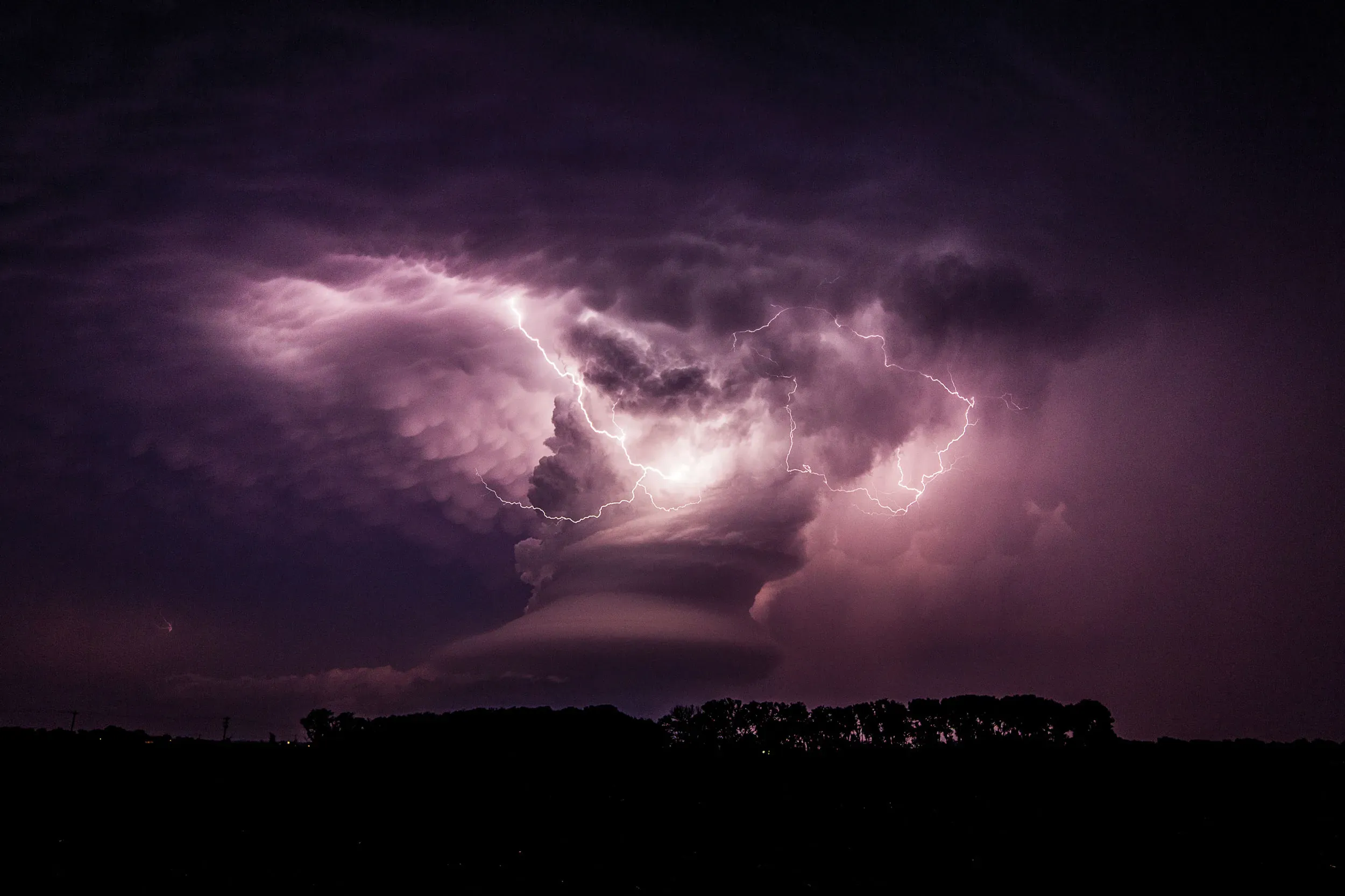
Atmospheric instability happens when a lifted parcel of air is warmer and less dense than its surrounding environment. Because it is warmer, it possesses positive buoyancy. It rises freely on its own. If you want to understand how atmospheric instability causes lightning storms, you just need to look at the basic physics of floating objects.
Meteorologists track this using the lapse rate. As altitude increases, air temperature generally drops. If the environmental temperature cools off faster than the rising pocket of air, the atmosphere is officially considered unstable. The rising bubble of moist air essentially acts like an invisible hot air balloon moving through the sky.
You need three specific elements for any thunderstorm to develop. The environment requires moisture, an unstable atmosphere, and a specific lifting mechanism to force the air upward. Intense surface heating from the sun provides that lift. An incoming cold weather front does the exact same thing.
The Science Behind Atmospheric Instability
Once the air starts moving upward, the internal physics of the storm take over. The process relies on thermodynamics and extreme temperature variations high above the ground.
- The Updraft and Latent Heat Engine. As the unstable, moist air is pushed upward, it cools. Water vapor condenses into cumulonimbus clouds. This condensation process releases latent heat. That heat warms the air parcel even further. It allows the air to accelerate upward and create a violent updraft.
- High-Altitude Charge Separation. Deep within the turbulent updraft, temperatures range between -15°C and -25°C. Supercooled water droplets, tiny ice crystals, and heavier soft hail called graupel continuously collide. The heavier graupel takes on a negative electrical charge and sinks to the middle or lower parts of the storm cloud. The lighter ice crystals take a positive charge and are swept to the top anvil of the cloud. This exact mechanism is documented in a detailed breakdown from the National Severe Storms Laboratory.
- The Electrical Discharge. The surrounding air normally acts as an insulator. But opposing electrical charges in the cloud continue to build up. They eventually break through the air’s insulating capacity. The result is a rapid, intense discharge of electricity. We know this as lightning.
- The Supersonic Thunder Shockwave. A lightning strike rapidly superheats the surrounding air channel. The temperature hits roughly 50,000°F in just a few millionths of a second. That is hotter than the surface of the sun. This incredibly fast heating causes the air to violently expand. It creates a high-pressure shock wave that propagates outward as the sound of thunder.
Real-World Examples or Applications
Forecasters look for extreme instability by measuring specific atmospheric indices. They rely heavily on Convective Available Potential Energy (CAPE) and the Lifted Index (LI). A CAPE value exceeding 2,500 J/kg signifies extremely large instability and a high risk of violent updrafts.
In August 2020, extreme instability triggered torrential rain showers in Afghanistan. The atmosphere recorded immense CAPE values of 2,632 J/kg. The resulting flash floods destroyed nearly 500 homes and claimed 150 lives in the Charikar region of the Daman Mountain Valley.
South Africa experienced a similar extreme weather event during the KwaZulu-Natal Thunderstorm in January 2005. CAPE levels exceeded 2,000 J/kg. Deep atmospheric convection punched right through a low-level capping inversion. The ensuing supercells generated extreme lightning, enormous hailstones, and flash flooding. Eight people died from lightning strikes in a single day.
More recently, the “Andhi” storms in Northern India during May 2026 showed how dangerous localized atmospheric clashes can be. Extreme surface temperatures exceeding 45°C collided with heavy moisture from the Bay of Bengal and cold, dry upper-air from Western Disturbances. This created intense thunderstorms with wind speeds reaching 130 km/h. The storms caused over 100 fatalities across Uttar Pradesh, according to a recent case study by Insights IAS.
What Scientists Still Don’t Know / Current Research
Meteorologists still struggle to predict the exact locations of these strikes days in advance. Convective thunderstorms are highly localized and develop incredibly fast. Forecasters must rely on a narrow “nowcasting” window of just a few hours to issue local alerts.
Climate change models add another layer of complexity. Additional heat trapped in the lower atmosphere directly increases general atmospheric instability. Models suggest that increased heat combined with wind shear will generate more violent updraft conditions and intense severe weather. But you still need sufficient moisture present for a storm to actually form. Predicting the exact regional effects of this excess heat remains difficult.
Common Myths Debunked
Many people assume thunderstorms are completely destructive and bad for the environment. But thunderstorms are essential for global electrical maintenance. Without continuous global lightning activity, the Earth-atmosphere electrical balance would completely dissipate within just five minutes.
Lightning also plays a vital role in atmospheric chemistry. The extreme heat and energy create ozone-producing chemicals. It alters atmospheric nitrogen into forms that are actually usable by plants.
Finally, there is a misconception that the physical blast of the strike or the wind causes the majority of infrastructure damage. Lightning that features longer-duration electrical currents is actually a primary igniter of wildfires. Furthermore, strikes routinely hit plumbing or power lines. They send hazardous electrical surges directly into homes that destroy electronics and harm occupants.