
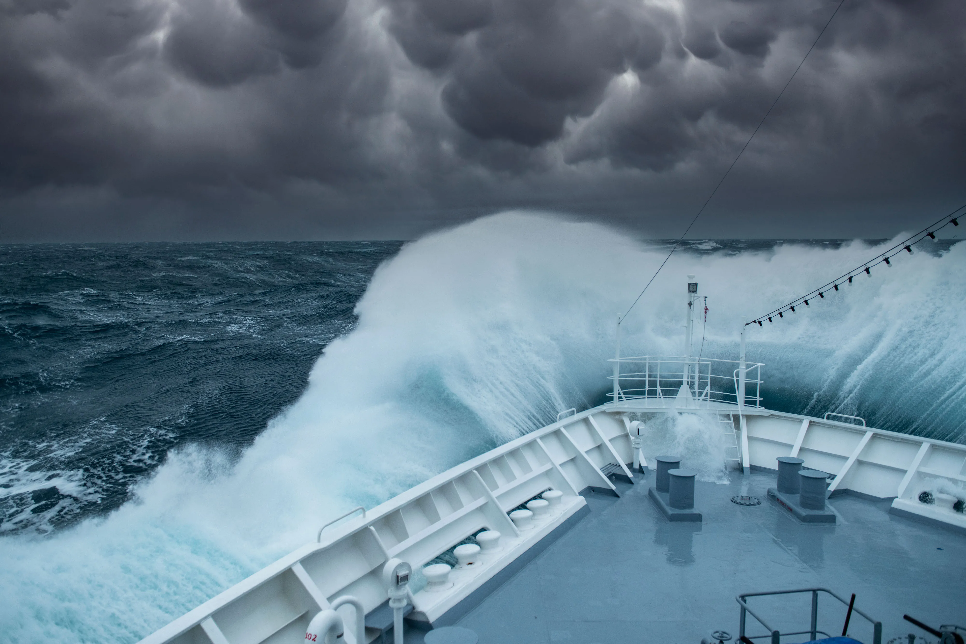
A low-pressure system forms in the ocean when warm, moist air over the water’s surface evaporates and rises quickly into the atmosphere. This upward movement leaves behind an “empty space” with significantly less atmospheric mass near the sea surface. That missing air creates a localized pressure minimum. Surrounding high-pressure air immediately rushes in across the water to fill the void. The Earth’s rotation then causes this rushing air to spin, kicking off a cycle that can build everything from a rainy afternoon squall to a powerful Category 5 hurricane.
It is absolutely incredible to watch satellite imagery of these systems organizing. The physics are simple, yet they power the largest weather events on the planet. I am constantly amazed by how a slight temperature shift over a patch of open water can dictate the weather for an entire continent days later. We track these atmospheric machines closely because understanding how they start is the only way to prepare for how they finish.
The Science Behind Ocean Low-Pressure Formation
Think about the air above the ocean like a physical weight resting on the water. We usually ignore it, but the atmosphere is heavy. When that air heats up, the molecules spread apart. The air becomes buoyant and lifts off the surface. This upward movement physically reduces the weight pressing down on the ocean below. Meteorologists measure this “weight” as barometric pressure.
The Evaporation Engine
The ocean acts like a giant thermal battery for the planet. Wind passes over warm ocean waters, causing surface moisture to evaporate rapidly. This warm marine air holds a vast amount of thermal energy. The process begins simply. Heat from the water forces warm ocean air to rise, which forms an area of low pressure underneath in tropical cyclones and other storm systems. The surface of the ocean literally loses air. The pressure drops, and the weather engine starts running.
The Condensation Cycle
Nature abhors a vacuum. Air from higher-pressure areas immediately rushes into this localized surface void. You feel this rushing air as wind on your face. This newly arrived air then warms up from the ocean heat and rises too. Once all that rising water vapor hits the freezing upper layers of the atmosphere, the physical state of the water changes. It condenses from an invisible gas back into liquid water droplets.
This phase change releases a tremendous amount of stored latent heat. That released heat warms the surrounding air aloft, forcing it to rise even higher. This builds towering cumulonimbus clouds that can reach 50,000 feet into the sky. Heavy precipitation naturally follows as the clouds reach their absolute moisture capacity.
Upper-Level Divergence
Sometimes the trigger for a surface storm comes from miles above the Earth. High-altitude winds and jet streams occasionally spread out, a process meteorologists call upper-level divergence. This spreading creates a severe shortage of air high in the sky. To balance the atmospheric column, air from the ocean surface is sucked upward like liquid through a straw. The ocean surface loses air mass, and a low-pressure system is born right at sea level. The fast-moving jet streams pull the exhaust out of the top of the storm, allowing the surface pressure to drop even further.
Tropical vs. Extratropical Storms: Two Different Engines
Oceanic low-pressure systems generally fall into two distinct categories. They take entirely different atmospheric paths depending on exactly where they form and what fuels their internal engines. The differences fundamentally alter how these storms behave.
Tropical Cyclones
These systems strictly form over warm ocean waters near the equator. They get their rotational power entirely from latent heat. The warm ocean water evaporates, rises, and releases stored energy when it condenses into storm clouds. As long as the water stays warm, the cycle repeats and the storm grows. Without that constant supply of warm water, a tropical cyclone quickly starves. This is exactly why hurricanes rapidly lose strength when they move over dry land or cross into cooler northern waters. They literally lose their main fuel source.
Extratropical Cyclones
These storms happen in the mid-latitudes and operate on a completely different thermal engine. They fire up when two totally different air masses collide in the open ocean. Usually, this means freezing polar winds crashing into warm, humid tropical air. The cold, dense air sinks downward and physically bulldozes the warmer, less-dense air, forcing it to rise rapidly. This forced lifting creates a sharp low-pressure zone at the surface. These storms do not need warm water to survive. They survive purely on the sheer temperature contrast between the two clashing air masses.
The Nor’easter Phenomenon
Geography dictates how these highly specific coastal events spin up. A Nor’easter forms when cold polar air meets the warm water of the Gulf Stream, causing a low-pressure system to develop quickly along the coastline. The intense temperature contrast between the freezing Canadian air and the balmy marine currents violently forces warm air upward. These extratropical systems routinely dump heavy snow, sleet, and freezing rain across the eastern seaboard of the United States. They paralyze major cities simply because cold polar air bumped into a warm ocean current.
Real-World Examples and Coastal Impacts
The invisible mechanics of low pressure generate highly visible, severe real-world destruction. When the barometric pressure drops, wind speeds naturally increase, and the open ocean reacts violently.
The Threat of Bombogenesis
When atmospheric conditions align perfectly, the surface pressure plummets at a terrifying rate. Meteorologists call this rapid intensification “bombogenesis.” If the barometric pressure in an extratropical low drops by at least 24 millibars within 24 hours, the system earns the title of a bomb cyclone. This creates a steep pressure gradient.
Think of a pressure gradient like a physical hill. The steeper the hill, the faster the air rushes down it to reach the bottom. These extreme gradients generate fierce winds that transfer kinetic energy directly into the water. This energy transfer produces towering, highly destructive ocean swells that travel for thousands of miles across open water.
Australian East Coast Lows
These intense marine weather events form off Australia’s eastern seaboard with devastating regularity. They pull in vast amounts of moisture from the Tasman Sea and hurl it directly at the coastline. History shows exactly how deadly these marine conditions get. One documented East Coast Low caused specific flooding in the Hunter Valley, multiple fatalities, and Sydney beach erosion from huge ocean swells. The sheer volume of water pushed ashore by the low pressure easily overwhelms local coastal drainage systems.
The 2018 Caribbean Swell Event
A powerful extratropical low formed way out in the Atlantic Ocean in March 2018. It never made direct landfall, but it sent huge swells racing toward the Caribbean. The open-ocean waves completely destroyed the Hotel Casa Isleña sea wall. Coastal roads completely flooded with ocean sand, and severe beach erosion fundamentally altered Hull Bay Beach in St. Thomas. The storm itself stayed safely far out to sea, but the low-pressure wave generation ruined coastal infrastructure without a single drop of local rain.
What Scientists Still Don’t Know
Researchers understand the basic mechanics of evaporation and pressure gradients clearly. The core physics are settled. The hard part is predicting exactly when a standard mid-latitude low will suddenly undergo rapid intensification. The exact atmospheric threshold where a routine storm tips into bombogenesis still creates intense forecasting challenges.
Measuring the precise transfer of kinetic energy from the wind into the water during wave generation is incredibly complex. Scientists continuously monitor upper-level jet stream divergence and slight changes in sea surface temperatures. Better satellite data helps them predict these extreme pressure drops slightly earlier, giving coastal communities more time to board up windows and secure boats. Still, predicting the exact hour a pressure gradient will steepen remains a difficult mathematical hurdle.
Common Myths Debunked
- All ocean storms are hurricanes. Extratropical cyclones and Nor’easters operate on entirely different thermal engines than tropical hurricanes. They rely on clashing cold and warm air masses rather than pure warm-water evaporation.
- Low pressure always means a storm is right overhead. The 2018 Caribbean Swell event proved otherwise. An extratropical low can form thousands of miles away in the open ocean and still devastate distant coastlines with long-range ocean swells.
- Rain causes the low pressure. It is actually the exact opposite. The falling atmospheric pressure forces the air to rise and condense, which then creates the rain.
- Low pressure requires freezing temperatures. Tropical cyclones are low-pressure systems entirely fueled by intense heat and warm equatorial water.
Frequently Asked Questions
How does a hurricane form from a low-pressure system?
A hurricane begins as a basic tropical disturbance. Warm, moist ocean air rises, creating an area of lower pressure underneath. High-pressure air from the surrounding environment rushes into this void, warms up, and rises in turn. As the air lifts and cools in the upper atmosphere, it condenses into giant cumulonimbus clouds and thunderstorms. The Earth’s Coriolis effect eventually causes this entire rising system to start rotating.
What defines a bomb cyclone?
A bomb cyclone is an extratropical low-pressure system that undergoes bombogenesis. This is a highly specific meteorological process where the central atmospheric pressure drops incredibly fast. To meet the definition, the pressure must fall by at least 24 millibars in a 24-hour period. This rapid drop creates a steep pressure gradient, driving fierce and highly destructive surface winds.
What causes a Nor’easter to form?
A Nor’easter spins up when extremely cold polar air blows southward out of Canada and collides with the warm ocean waters of the Atlantic Gulf Stream. The sharp temperature contrast between the freezing air mass and the warm ocean current violently forces the marine air upward. This creates a deep low-pressure system that drives heavy cloud formation and intense precipitation along the coast.